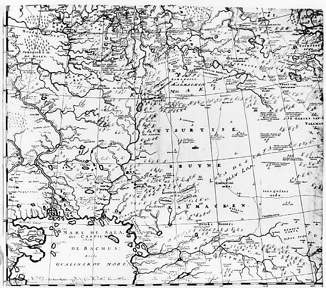
Печатный источник:Nieuwe lantkaarte van het noorder en ooster deel van Asia en Europe strekkende van Nova Zemla tot China. [n.p.] 1687. Nicolas Witsen, Burgomeister of Amsterdam, accompanied a Dutch embassy to Moscow in 1664 and thereafter maintained correspondence with people in several parts of Russia and its empire, enabling him to compile information for this map which was considered the best map of inner Asia in the seventeenth century. It is printed in four sheets, each about 24 inches square. WEB-источник:University of Minnesota, Twin Cities