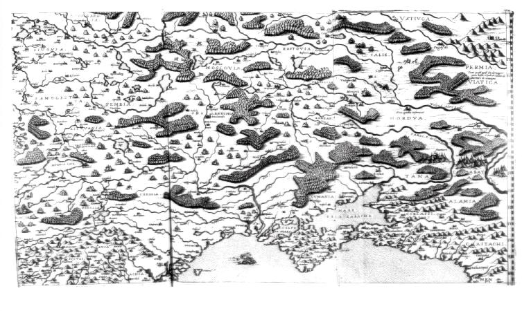
Печатный источник: [Atlas.] Venice, 1560 - 1575 A collection of thirty-four maps issued by Camocio between 1560 and 1575, bound together atlas-fashion but without text, includes four which portray parts of Russia. This one shows the southwestern area including the Volga, Don, Dnieper and Dvina rivers. The map is attributed to Giacomo Gastaldi.