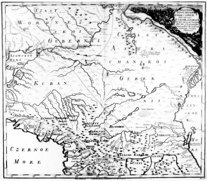
Печатный источник:Atlas Russicus. St. Petersburg, 1745.
“Territorium Pontum Euxenium et Mare Caspium ” No. 11.
This atlas of Russia was issued by the Imperial Academy of Sciences of St. Petersburg. It contains a general map of Russia and nineteen regional maps. This one portrays the region between the Black and Caspian seas, including the lower course of the Volga River. It is based on surveys and travel accounts of the region.
WEB-источник:University of Minnesota, Twin Cities